The Free World Forces in Vietnam always declared a truce and
stopped operations against the VC and NVA on significant public and religious holidays. In return these truce were not always honoured by the NVA/VC; one major
example known as Tet’68 was the country wide offensive at the end of January 1968 when the NVA used the Vietnamese New Year
truce and stand-down in allied operations to attempt to o
For Christmas
1969 the majority of W3 Coy was concentrated on the North side
of the Nui May Tao mountains
but 1Pl and the mortar sect were at FSPB PICTON. At PICTON
the first sign of
the Australian celebrations occurred during
the darkness after stand-down on Christmas Eve when the song ‘Silent Night’ suddenly drifted across the base from the
pitch black skies above. A Pilatus Porter psy-ops aircraft from 161 Recce Flight at Nui Dat fitted with loudspeakers to broadcast political
messages to the VC had for the evening been given a new role playing Christmas carols to its own side deployed in the bush.
Invisible and able to drift slowly across the sky, the plane moved back and forth for over an hour entertaining the troops and
remind
At midnight the 6RAR padre led 60 or so soldiers out across the LZ to stand just inside the wire for a church service. We stood with our backs to the wire [and any likely threat from outside the base] while the padre reminded us of the message of Christmas – peace love reconciliation and grace, in sharp contrast to the otherwise daily business of the unit. After a 30–minute service with carols nervously sung by torchlight we returned to our dugouts and duties.
Christmas morning Santa Claus visited the base, courtesy of 9Sqn RAAF who rather spoiled the occasion by painting on their helicopter doors the message “merry Christmas oink oink you grunts”. Santa spoke to the CO and other base staff while looking resplendent in his red suit with black belt and 9mm Browning pistol. The fresh rations delivered with the helicopter were a cut above the normal breakfast.
After breakfast the 6RAR
Pipe-major entertained the troops with a few bagpipe renditions, after which we spent the remainder of the day relaxed
in-place, with t
The base was abandoned on 27 December when 2RAR returned to Nui Dat but W3 Company was almost immediately redeployed on a 3-day operation [Op Bluewater] and didn’t actually celebrate Christmas in the traditional way until 1 January 1970.
I Was There - Stephen Fitzsimmons 104 Sig Sqn, "I had forgotten about Silent Night, thanks for the reminder. I remember Santa arriving with the red smoke trailing behind the Huey, the caption on the side of the chopper actually said "Merry Christmas to all oink oinks", I don't think they meant any disrespect by it. We were given one goffer between two of us as a Christmas treat". 'I Was There' - add a comment what was your Christmas 1969 experience..?
During our first operation, Op Marsden, 1 Pl was sent into Fire Support Base Picton for a few days to provide local protection. It was just before Christmas 1969. Dave Turner and I were hoochied up together near the chopper pad in a little sandbag-lined hole with a reassuringly thick sandbag and curved ARMCO cover over the top. On the whole, this protection job was a pretty cushy number but, like the Curate’s egg, there was a drawback; the downside of the whole arrangement was that Bn HQ was also there and this meant being in much closer proximity to its august personages than we thought was likely to be a good thing. And we were right. The 6RAR RSM, one WO1 Cruikshank, was a desiccated, humourless, rail-thin Jock and he had established a substantial little palace about 25 metres away from our rather austere and less substantial one. There he sat for the better part of his time, in a canvas folding chair, glaring all about from under the brim of his jungle hat like a dyspeptic bullfrog and dreaming, as I imagined RSMs were wont to do, of extra drill parades, Regimental Entries, barrack inspections, and naughty soldiers undergoing the delights of field punishment.
You’ll remember how noisy fire support bases
were, especially by day with guns, mortars, APCs, helicopters,
trucks and all the rest of it collectively producing a cacophony
of banging, clanking, roaring, clashing, grinding and thumping
sounds. And the sound signature aside it was impossible to hide
their physical footprint – a huge round scab on the landscape,
surrounded by a berm or barbed wire, or both. All in all, a
blind man could have seen what was going on there and the facts
of their presence and location couldn’t possibly have been a
secret. Of course, things quieted down a bit at night and we
cunningly went to night routine to hide the huge installation –
you know: bellowing at each other in hoarse whispers; groping
in the dark by badly shielded torchlights; the occasional ‘Ow!
Shit!’ as someone blundered into a sharp and unyielding object
and forgot about the whispering part; all at the same time. But
the base was still where it had been in daylight and there was
still plenty of noise going on. Now, Dave was pretty easy to get along with other than the fact that he was given to a bit of snoring, and some of it was not only of pretty heroic proportions but also showed a fair range and variety as well. My personal favourite, delivered from a wide-open mouth, came from somewhere deep in his throat with the moaning scream of a 155 howitzer shell passing overhead to explode at the back of his nose with the nasty crack of a mortar bomb landing ‘danger close’. But I liked his 4-stroke engine impression too: a snorting gasp of air on the intake stroke; followed by a gentle rumbling interlude for a slow compression; changing abruptly to a gargling shout from his barrel chest at the combustion stroke; and ending on the exhaust stroke with a series of little smackings of the lips as you might after a tasty morsel. But amongst all the other night sounds of the base and the jungle neither I never thought that his nose work amounted to much. Yes, well….. Our first night in Picton. The guns were tucked up for the night; the mortars had ceased their asthmatic coughing; the vehicles had been last-paraded and parked up; the Hueys were all crouched at Vung Tau and their crews were in their air-conditioned bars; sentries peered blearily into the nothingness over their gun sights and fiddled with starlight scopes that they didn’t know how to work; the enemy told their chums where the fire support base was and they all avoided it like the plague. And Dave snored on. The next morning after Stand Down the RP Sergeant arrived at our little hacienda to inform Dave that his adenoidal activity had disturbed Mr Cruikshank’s slumbers. I think the minion’s actual words (delivered in that broad Australian twang that we knew and loved so much) were something like, ‘Hey Kiwi! RSM wants yizta shut up ya bloody snorin’. Yiza makin’ too much bloody racket! Bastard’s been on me back about it ‘alf the bloody night!’ I was a bit puzzled about all this fuss. Couldn’t actually see the problem – no amount of beauty sleep was going to make a scrap of difference to the RSM’s look (or to his outlook, for that matter), and Dave’s snoring was hardly likely to unmask the base’s location given the local competition he faced in noise generation. And so, to Christmas Eve. Out of the darkness a throaty, wheezing sound wobbled across the base swelling to a hideous keening like an Irish widow at a wake. The noise turned into a reedy squealing and screeching that rose and fell in no discernible rhythm or pattern, like a badly out of tune children’s recorder band. Was this some new psychological devilry of the enemy? Had the pressure in the hot water boiler reached critical mass and was the whole ramshackle affair about to explode? Was someone’s stomach reacting badly to the Ham and Lima Beans they’d wolfed down for their evening meal? Was some lonely soldier taking a chance on making himself go blind? In the dark, it was all rather alarming. Hang on a minute though, thinks I. It’s a bit like music, but different! Of course - bagpipes! The RSM had had the Pipe Major flown in to play a Pibroch (or something) in the dark to celebrate the arrival of Christmas. All his previous concerns about things that went bump or snore in the night were forgotten as he transported himself in dreams to his beloved Highlands and its snow, whiskey, haggis and Hogmanay. The Pibroch (or something) ground on, eventually winding down and petering out as though someone had stuck a bayonet in Pipey’s wind bag. And Dave’s voice rang out across the chopper pad, in a very fair imitation of the Australian twang, ‘Shut up ya bloody noise! Yiza makin’ too much bloody racket! Bastard’ll be on me back about it all bloody day!’
It would be nice to report that Dave had had the
last word in all this. Sadly, not. With the arrival of
daylight and the resumption of the usual damaging noise levels
within the fire support base Dave was invited by the RSM to
participate (and without the offer of a cup of coffee,
apparently) in a brief, one-sided and somewhat painful
discussion of their cultural differences and relative positions
in the military hierarchy. Dave said he took one look at the
RSM’s face and decided it probably wasn’t the right time to
raise the matter of the the midnight Carol Service that the RSM
had arranged to follow the piping. It’s the war, you
know! (Deep sigh.) |
||
Navigation and Indirect Fire Control Under the Canopy - Bruce Young
Whenever a platoon deployed on an operation it would do so into an AO [area of operations] defined by a series of map coordinates. It was required that the platoon remained inside those coordinates to avoid bumping into other friendly troops. It was also a requirement to pass regular ‘locstats’ so commanders and those required to coordinate indirect fire support clearances could know where the troops were. There were many instances where inaccurate locstats led to friendly artillery fire landing on the unfortunate ‘lost’ troops. As a MFC I can well remember the cringe I developed each time I waited for the first round of a fire mission to land, hoping that that day I had not made a major mistake and someone was about to be injured unintentionally. It was because this scenario was so prevalent that the first indirect round of any engagement was required to land 1000 metres away from any friendly forces. Ever resourceful, the troops used ‘dead reckoning’ to overcome the limitations. ‘Dead reckoning’ in Vietnam required the troops to march on a compass bearing from a known point and to record the number of paces taken between stops. At a tactical stop groups of soldiers would mutually review the distance, bearing, and nature of the ground covered to arrive at a reasonably accurate consensus. In a typical platoon this group would include the platoon commander [ultimately responsible for the locstat] the lead section commander [who had seen the vegetation in front of the platoon] and the element in platoon headquarters responsible for managing indirect fire. Given I spent 90% of the time focussed on navigation I was frequently impressed by the accurate navigation done by the lead section commanders who could only safely think about navigation perhaps 20% of the time [the remainder of their time being devoted to directing their scouts, analysing the terrain, and generally ensuring the platoon was not surprised tactically by the enemy].
The next aid was a pace [or tally] counter, normally attached to the personal weapon and pressed for each pace the left foot took [on average in close-country a step with each foot would equal a metre]. A comparison of the different pacing records would give an average of the likely distance the platoon had moved. With these two aids a direction and a distance travelled in that direction gave a rough estimate of the present location. The next aid was a topographical map [sometimes a photo map was
also provided if the terrain in the area had been extensively altered]. Although showing few obvious features it was
surprising how accurate reading the map could be. A study of the few contours, stream directions, shape of clearings,
and changes in vegetation all assisted the navigation group to take their average and refine it into a locstat accurate to
within 100 metres. Dead reckoning however required that the start point be accurately established, something not always
possible given the usual sudden arrival by helicopter into a jungle clearing with the subsequent mad scramble to get clear of
the open spaces.
This topographical map from the Hat Dich area of Phuoc Tuy province shows the amount of detail
typically available: cultivation on right edge, small hill to South, streams to West, small changes in altitude [contour
lines] in the middle, clearings to the bottom right. While there appears to be plenty of topographical variety the
likelihood of any feature actually being seen on the ground from more than 50 metres away is slim. The photo from the
same area shows why:
The final aid was a circular protractor. In the military
these are in mils [civilians use degrees] and are used to plot bearings from a compass onto a map [such as a resection] or to obtain bearings from a map on which to march A request for indirect fire support could be made when in contact, or when contact might be anticipated [such as at an ambush site] and always had three main elements: 6-figure map reference [locstat of target] pinpointing where on the ground the indirect fire was ultimately
required [usually the present enemy position or their anticipated escape route].
Providing your own locstat as the point from which the mandatory
1000 metre safety addition was made was not recommended for if
the supporting artillery plotted the locstat BUT forgot to add
the safety margin the fire would land on your location.
Fortunately indirect fire controllers could use the explosions from indirect fire as an aid to help them establish an accurate locstat since knowing the location of the explosions allowed the observer to do a compass resection; shooting a compass bearing to the known point and converting it into a back bearing to establish a line back to your own position. Depending on the situation there were three approaches to using the indirect fire; all were similar in application. 1. If there was no urgency to provide an accurate locstat the sneaky approach was to eavesdrop on the fire control net until another call sign close by asked for a fire mission. Details in the fire request included a grid reference, adjustment compass bearing, and a safety addition. Using this information to plot where the rounds would fall and doing a compass backbearing on the explosion would provide feedback as to your own position. 2. If there was an urgent requirement to establish your location the anguished approach was to request a ‘mark mission’, meaning the artillery would fire on one or more spots to allow the compass resection to take place. Mark missions however were unpopular, receiving very low artillery priority and platoons often couldn’t afford to wait for it to come to the top of the fire mission task list. It also implied the platoon was poor navigators, liable to ridicule from the artillery involved. 3. The subtle approach used the nightly defensive fire [DF] tasks to get the compass resection. Nightly DF tasks were routine but for the purpose of compass resection needed to be done using false direction, which also provided an extra degree of safety to the platoon calling the DF. I preferred the subtle approach. Let’s examine the safety issue in more detail. Using ‘dead reckoning’ involves a compass bearing and measuring distance moved from a known point. In close country a compass bearing is accurate enough to keep direction, subject only to a slight user bias [e.g. where a person always goes left around any trees blocking the route and over time would be to the left of where the bearing is pointing]. But pacing had the potential for greater error; starting from an imprecise point, assuming every left pace was a metre, not compensating for downhill or uphill movement, etc. This meant firing indirect weapons along the same axis as the bearing could reduce the safety margin to a dangerous level but could be overcome by having the safety margin to one side [see diagram] as the degree of error sideways would likely be smaller than the degree of error from movement along the bearing.
Having the DF located 300 metres in front meant the second round was on an angle that allowed me to not only have a different back bearing with each round but also enabled me to establish distance. It also meant the artillery round was not dropping straight toward me in case there were errors on the firing line. I also found that sticking to cardinal points of the compass assisted me maintain a picture in my head as to where indirect fire was falling and what I next needed to do when adjusting it. The use of false direction is not inherently dangerous [in my view was safer than the direct bearing method] but was not embraced by all – especially the battery commander of the 2RAR close support field artillery battery. In his mind it broke some ‘rule’ of indirect fire and he would decline my fire missions if he thought I was using it. At other times the close presence of civilian access areas meant I had to calculate an adjustment bearing off the map to fit into the allowable free-fire area. One night when 2Pl were ambushing a waterway in the Rung Sat I dog-legged the adjustments around civilian access areas to achieve a close DF in case VC moved along the waterway during the night, to later find that the outgoing tide had drained the waterway down to mud. I guess you can’t win them all..? [see this link for another story on navigation going wrong] [see this link for a story on poor navigation] |
![161 Recce Flt Pilatus Porter PC6 at Nui Dat [internet]](images/pilatusporter.jpg)
![Santa at FSPB Picton Christmas Day 1969 [Young]](images/Xmas_Picton_small.jpg)
![Pipe-major 6RAR Christmas morning FSPB Picton [Young]](images/XmasPipes_Picton_small.jpg)
 I
Was There - Craig Cocker 1Pl
I
Was There - Craig Cocker 1Pl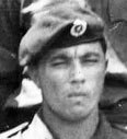
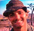
![Lcpl Bruce Young - Nui Dat 1970 [Young]](images/young_head.jpg)
![British M73 prismatic compass used in Vietnam [internet]](images/M73MilitaryCompass3.jpg)
![pace counter used in Vietnam [and still available today] [internet]](images/nav_df_pace%20counter.jpg)
![topographical map Hat Dich area Phuoc Tuy province Vietnam [Young]](images/Nav_df_map_hatdich.jpg)
![troops among the vegetations in the Hat Dich [AWM]](images/Nav_DF1.jpg)
![military artillery protractor of the sort issued in Vietnam [internet]](images/nav_df%20raa-protractor.gif)
![map demonstrating the process of adjusting a DF using 'false direction' [Young]](images/nav_df_map%20Demo.jpg)